Geotechnical Cross Section Free Autocad Template
1 February 2025Table of Contents
Geotechnical Cross Section Free Autocad Template
A geotechnical cross section is a crucial tool in civil engineering, providing a detailed representation of subsurface conditions for construction projects. By illustrating soil layers, rock formations, and groundwater levels, geotechnical cross sections help engineers design stable and safe foundations for infrastructure. In this article, we will explore the importance of geotechnical cross sections, their applications, and how using CAD templates can streamline the design process.
What is a Geotechnical Cross Section?
A geotechnical cross section is a vertical cut through the ground that visually represents subsurface conditions at a specific location. This section displays soil stratigraphy, groundwater levels, borehole data, and geotechnical properties necessary for engineering analysis.
Importance of Geotechnical Cross Sections
- Foundation Design: Helps determine soil bearing capacity and foundation requirements.
- Slope Stability Analysis: Identifies potential landslide risks and necessary reinforcements.
- Excavation Planning: Assists in determining excavation depth and support systems.
- Groundwater Management: Helps design drainage and dewatering solutions.
- Soil-Structure Interaction: Provides insights into how soil layers affect structural integrity.
How to Create a Geotechnical Cross Section
Creating a geotechnical cross section involves:
- Collecting Geotechnical Data: Soil sampling, borehole logs, and laboratory testing.
- Analyzing Soil Layers: Identifying different soil strata and their properties.
- Plotting Borehole Data: Using CAD software to visualize subsurface conditions.
- Incorporating Groundwater Levels: Understanding how water flow affects the design.
- Labeling Key Features: Including soil types, depths, and geotechnical parameters.
Using CAD Templates for Geotechnical Cross Sections
Manually drafting geotechnical cross sections can be time-consuming and prone to errors. A well-designed Geotechnical Cross Section CAD Template simplifies the process, ensuring accuracy and efficiency. These templates provide pre-formatted layers, symbols, and scales, allowing engineers to quickly generate professional geotechnical profiles.
For a high-quality CAD template that enhances your geotechnical design workflow, check out the Geotechnical Cross Section CAD Template DWG. This template includes essential features such as borehole logs, soil layer representation, and customizable labels, making it an invaluable tool for engineers and designers.
Conclusion
Geotechnical cross sections are vital for understanding subsurface conditions and ensuring safe, efficient construction projects. By utilizing CAD templates, engineers can enhance their design accuracy and productivity. For a ready-to-use geotechnical cross-section template, visit CADTemplates.org and streamline your geotechnical documentation today.
More from my site
 Estimation of Soil Improvement by Vibro Replacement Spreadsheet
 Soil Liquefaction Evaluation Spreadsheet
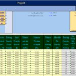 AASHTO GeoTechnical Design of Pile Spreadsheet
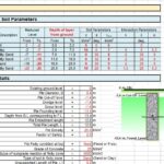 Pile Capacity All Calculations Spreadsheet
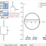 Mohr’s Circle Drawing Spreadsheet
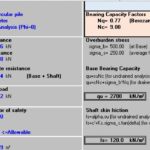 Simplifying Pile Capacity Calculations: A Powerful Spreadsheet Tool for Engineers