What is Compass Surveying
24 December 2019 Off By The Engineering CommunityTable of Contents
What is Compass Surveying
INTRODUCTION
Compass surveying is the branch of surveying in which directions of survey lines are determined with compass and the lengths of the lines are measured with a tape or a chain. In compass surveying the direction of survey line called the bearing of line is defined as the angle made by the line with the magnetic meridian. In practice compass is generally employed to run a traverse. Traverse consists of series of straight lines connected together to form an open or closed traverse.
COMPASS
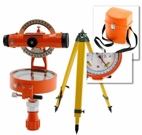
The commonly used instrument for compass surveying is Compass. A compass is small instrument which consists essentially of magnetic needle, a graduated circle and a line of sight. When the line of sight is directed towards a line, the magnetic needle points towards magnetic meridian and the angle which the line makes with the magnetic meridian is read at the graduated circle.
Compass consists of cylindrical metal box of about 8-12 cm diameter in the center of which is a pivot carrying a magnetic needle which is already attached to the graduated aluminum ring. The ring is graduated and is read by reflecting prism. Diametrically opposite to the prism is the object vane hinged to the box side carrying a horse hair with which the object in the field is bisected.
TYPES OF COMPASS
There are two forms of compass as under
- Prismatic compass
- Surveyors compass
The two compass are almost same except few differences so far as their construction is concerned. Prismatic compass uses WCB (0⁰-360⁰) circular ring while as the surveyors compass uses Quadrantal Bearing (0⁰-90⁰) circular ring system. Besides bearing system, the former has graduated ring attached to magnetic needle as the result of which when compass box and sight vane is rotated the needle remains stationary on the other hand in surveyors compass graduated ring being attached to compass box moves with it as the box is rotated
ADJUSTMENT OF COMPASS (WORKING)
Working of compass involves three steps:
- CENTERING
- LEVELLING
- OBSERVING THE BEARING
Centering involves to align the compass is such a way the Centre is placed vertically over the station point. It is done with the help of tripod stand and is checked by dropping a small pebble below the Centre of compass.
Levelling is done so that the graduated ring swings quite freely. It is done with the help of ball and socket arrangement and can be checked by rolling a round-pencil on the compass box
Observing the bearing once centering and levelling has been done, raise or lower the prism until the graduations on the ring are clearly visible when looked through the prism. Afterwards turn compass-box until the ranging rod at the station is bisected by horse-hair of objective vane. At this position note down the reading.
COMPASS TRAVERSING
Whenever in traversing compass is used for making angular measurements, it is known as compass traversing or compass surveying. In compass traversing, the compass is used to determine the direction of survey lines of the framework of the traverse for measuring the angles which these lines make with the magnetic meridian.
The process of chaining and offsetting is the same as in chain surveying and running the check lines is not necessary. Compass traverse may be closed or open. Close traverse starts from one traverse station and closes either on same or on another traverse station whose location is already known. On the other hand an open traverse starts from one station and closes at other station whose location is neither known nor established.
EQUIPMENT USED IN COMPASS SURVEYING
- PRISMATIC COMPASS
- MEASURING TAPE
- RANGING RODS
- PLUMB BOB
- CHAIN
- CROSS STAFF
MEASUREMENT OF INCLUDED ANGLE
In a compass (prismatic) which uses Whole Circle Bearing (0⁰ to 360⁰) system the included angle is given by
| Included angle = F.B of next line — B.B of previous line at same station |
PRECAUTIONS
Compass surveying is used in case of rough surveys where speed and not accuracy is main consideration. One of the biggest disadvantages of compass is that magnetic needle which gives bearing of lines is disturbed from its normal position in presence of materials such as iron-pipes , current carrying wires , proximity of steel structures , transmission lines etc. called sources of local attraction.


